Extracted images: N.J.A.C. 7:13 — Flood Hazard Area Control Act Rules
Printed revision: Last amended: January 20, 2026.
Back to source | Original PDF | Image metadata
Original Mistral crops are preserved byte for byte. A crop can be a figure, table, equation, or other visual; no visual content is inferred as a numerical rule. Record and table associations use the same PDF page unless a direct image placeholder is identified. Nearby OCR excerpts are context, not verified captions.
PDF page 31, image 1
Mistral ID: img-0.jpeg. Extraction bundle(s): njac7_13_OCR. Original page | Image file
Surrounding OCR excerpt:
IN TITLE 7 OF THE NEW JERSEY ADMINISTRATIVE CODE.

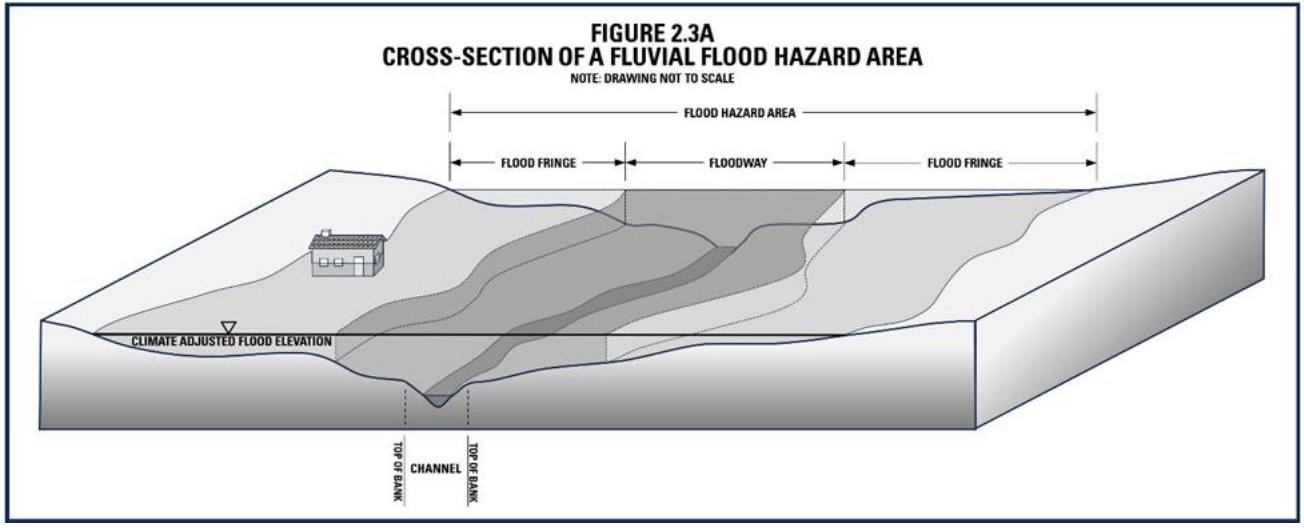
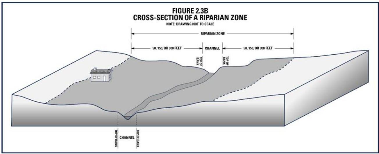
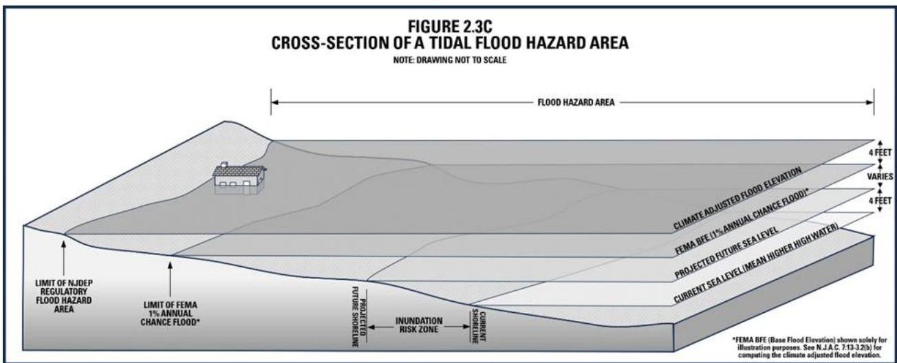
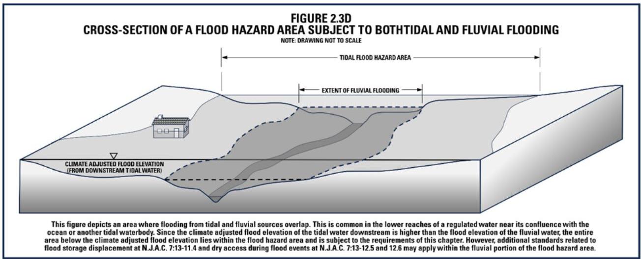
(Agency Note: Figures 2.3A, 2.3B, 2.3,C, and 2.3D below are intended to replace existing Figures 2.3A and 2.3B, without symbolism indicating the changes.)

[OCR image]

[OCR image]

[OCR image]
PDF page 31, image 2
Mistral ID: img-1.jpeg. Extraction bundle(s): njac7_13_OCR. Original page | Image file
Surrounding OCR excerpt:
EY ADMINISTRATIVE CODE.

(Agency Note: Figures 2.3A, 2.3B, 2.3,C, and 2.3D below are intended to replace existing Figures 2.3A and 2.3B, without symbolism indicating the changes.)

[OCR image]

[OCR image]

[OCR image]
PDF page 31, image 3
Mistral ID: img-2.jpeg. Extraction bundle(s): njac7_13_OCR. Original page | Image file
Surrounding OCR excerpt:
gency Note: Figures 2.3A, 2.3B, 2.3,C, and 2.3D below are intended to replace existing Figures 2.3A and 2.3B, without symbolism indicating the changes.)

[OCR image]

[OCR image]

[OCR image]
PDF page 32, image 1
Mistral ID: img-3.jpeg. Extraction bundle(s): njac7_13_OCR. Original page | Image file
Surrounding OCR excerpt:
[OCR image]

# 7:13-2.4 Regulated activities

(a) Except where exempted from this chapter pursuant to N.J.A.C. 7:13-2.5, any action that includes or results in one or more of the following constitutes a regulated activity pursuant to this chapter if undertaken in a regulated area, as described at N.J.A.C. 7:13-2.3:1.

1. The alteration of topography through excavation, grading and/or placement of fill;
2. The clear
PDF page 54, image 1
Mistral ID: img-4.jpeg. Extraction bundle(s): njac7_13_OCR. Original page | Image file
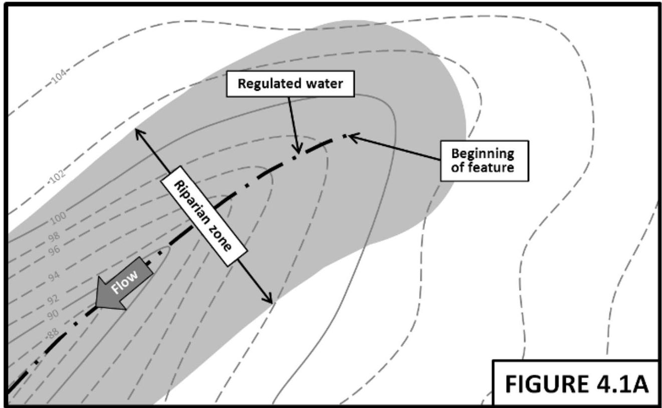
Surrounding OCR excerpt:
[OCR image]

[OCR image]
PDF page 54, image 2
Mistral ID: img-5.jpeg. Extraction bundle(s): njac7_13_OCR. Original page | Image file
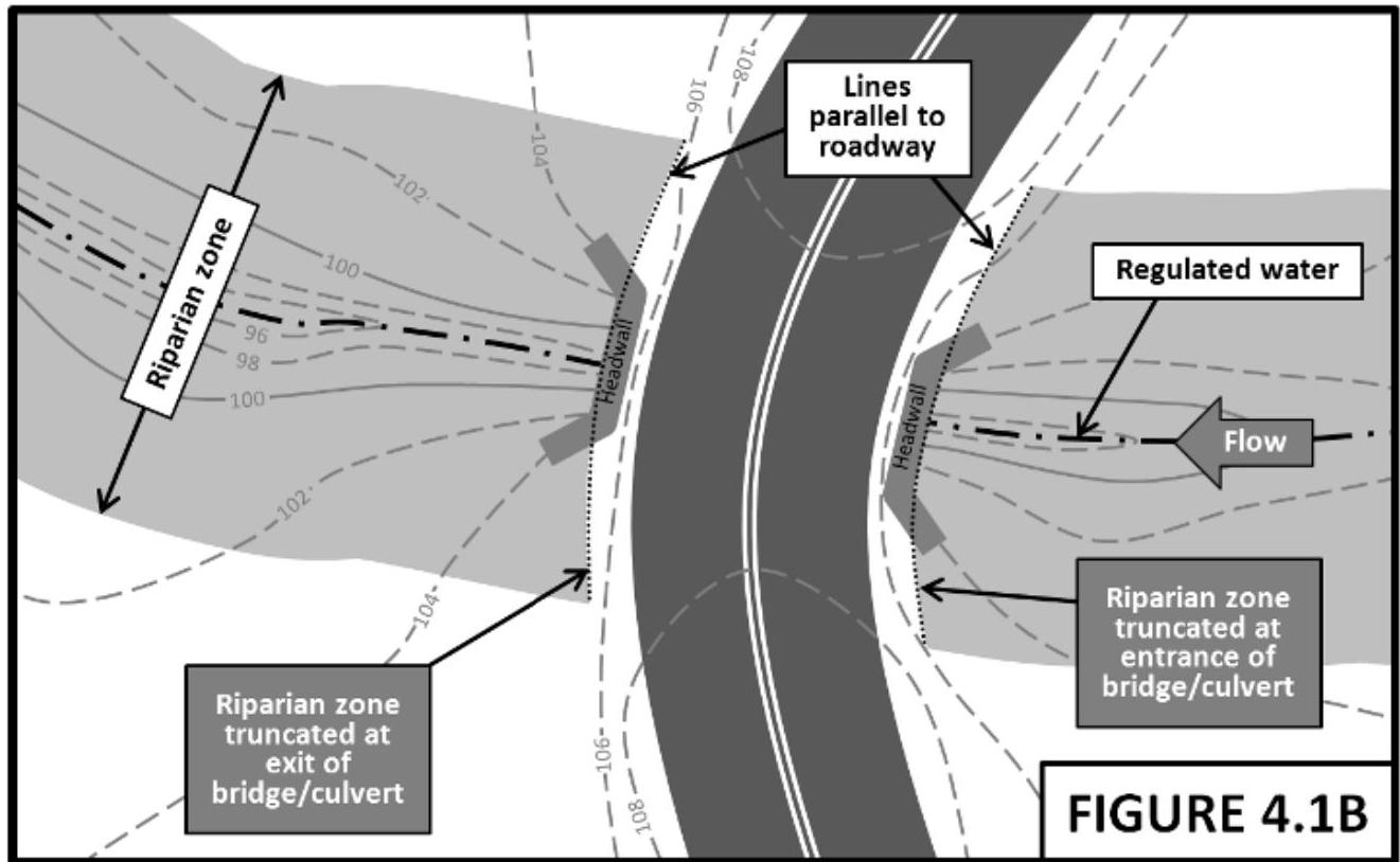
Surrounding OCR excerpt:
[OCR image]

[OCR image]
PDF page 55, image 1
Mistral ID: img-6.jpeg. Extraction bundle(s): njac7_13_OCR. Original page | Image file
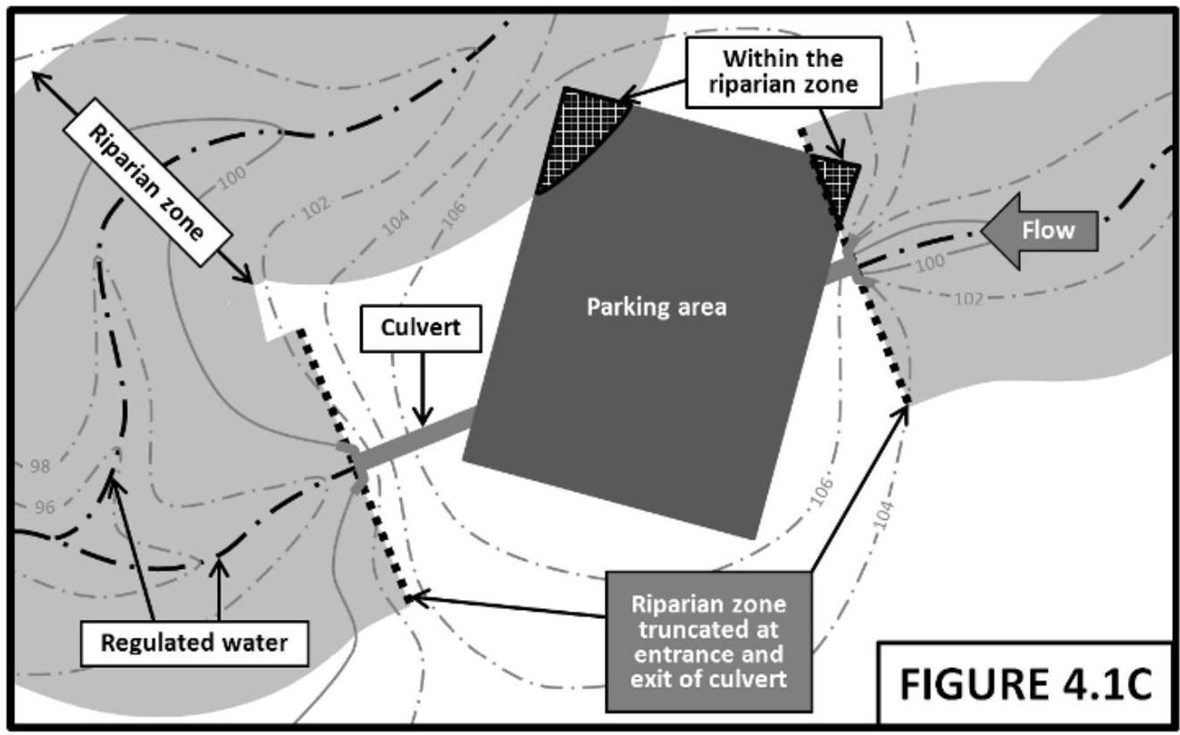
Surrounding OCR excerpt:
[OCR image]

[OCR image]
PDF page 55, image 2
Mistral ID: img-7.jpeg. Extraction bundle(s): njac7_13_OCR. Original page | Image file
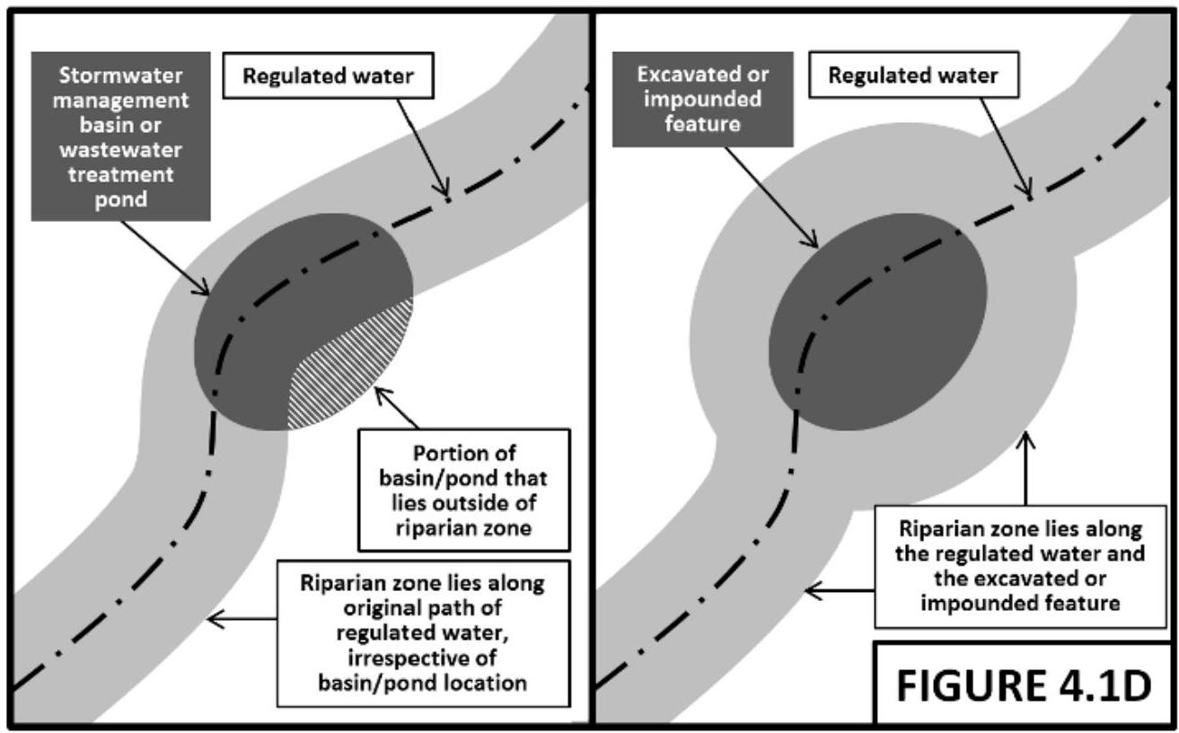
Surrounding OCR excerpt:
[OCR image]

[OCR image]
PDF page 56, image 1
Mistral ID: img-8.jpeg. Extraction bundle(s): njac7_13_OCR. Original page | Image file
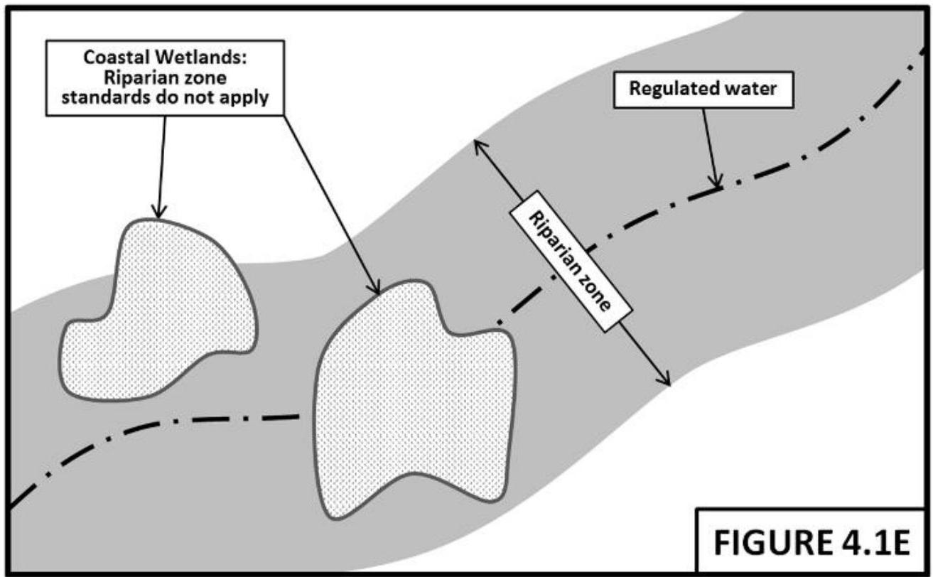
Surrounding OCR excerpt:
[OCR image]

# 7:13-4.2 Determining if a riparian zone is forested or unforested

(a) This section specifies the process for determining if an area is classified as forested or unforested. Once an area is determined to be forested in accordance with (b) or (c) below, the limit of the forested area is determined pursuant to (d) below.

(b) To determine if a riparian zone or portion of a riparian zone is forested:

1
PDF page 260, image 1
Mistral ID: img-9.jpeg. Extraction bundle(s): njac7_13_OCR. Original page | Image file
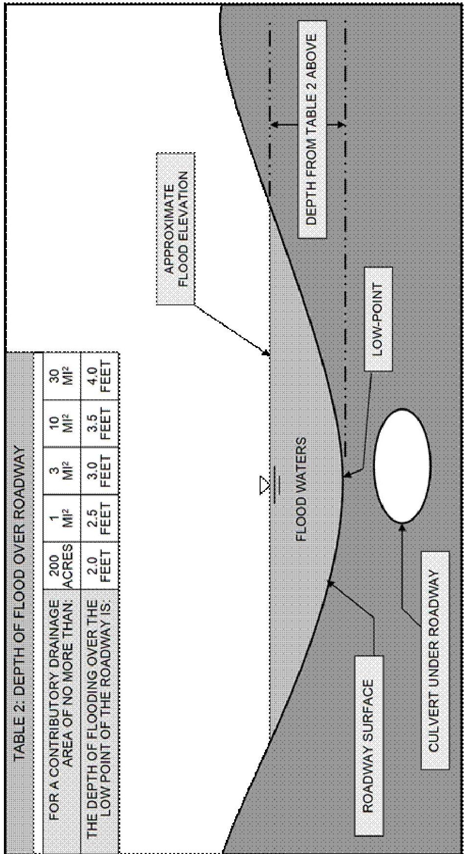
Surrounding OCR excerpt:
[OCR image]
FIGURE 1
PROFILE OF A ROADWAY OVERTOPPED BY FLOOD WATERS
NOT DRAWN TO SCALE
PDF page 261, image 1
Mistral ID: img-10.jpeg. Extraction bundle(s): njac7_13_OCR. Original page | Image file
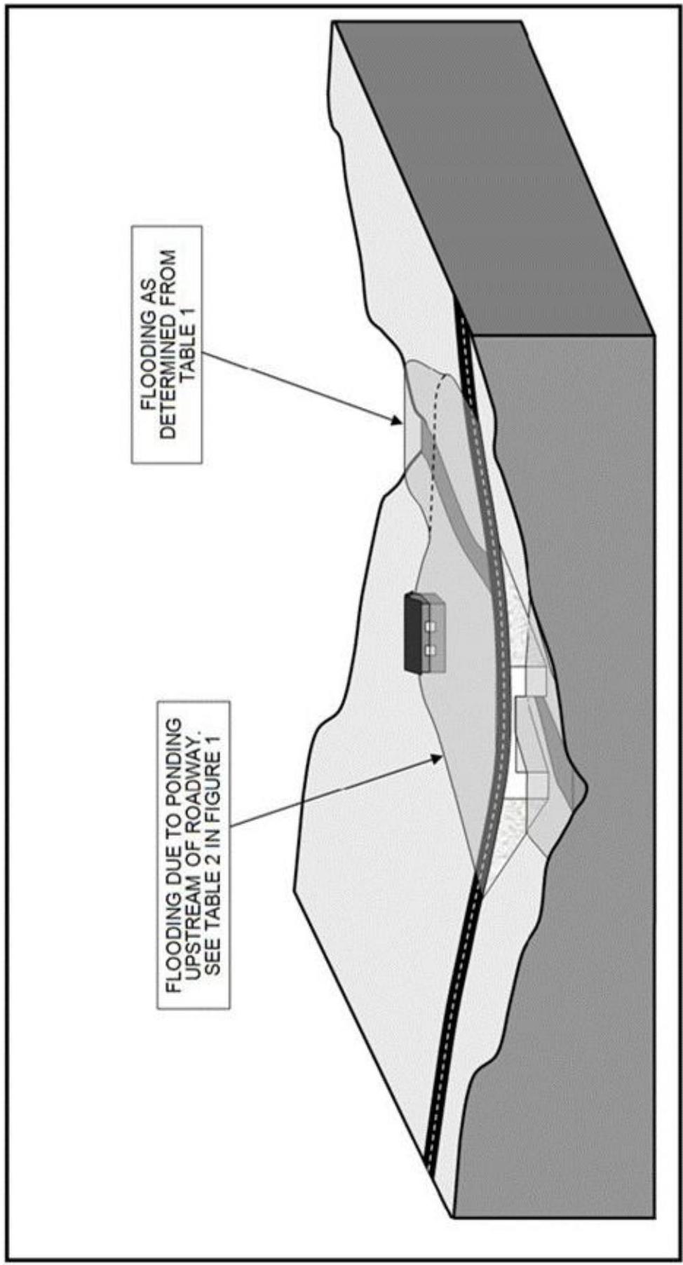
Surrounding OCR excerpt:
[OCR image]
THIS IS A COURTESY COPY OF THIS RULE. ALL OF THE DEPARTMENT'S RULES ARE COMPILED IN TITLE 7 OF THE NEW JERSEY ADMINISTRATIVE CODE.
FIGURE 2
THREE-DIMENSIONAL VIEW OF APPROXIMATE FLOOD HAZARD AREA
NOT DRAWN TO SCALE
PDF page 262, image 1
Mistral ID: img-11.jpeg. Extraction bundle(s): njac7_13_OCR. Original page | Image file
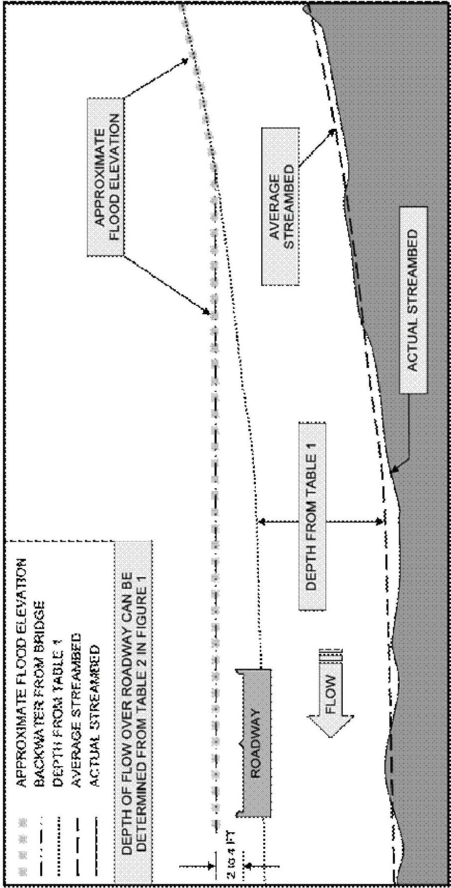
Surrounding OCR excerpt:
[OCR image]
FIGURE 3
PROFILE OF A TYPICAL CHANNEL WITH AN APPROXIMATE FLOOD HAZARD AREA
NOT DRAWN TO SCALE
PDF page 263, image 1
Mistral ID: img-12.jpeg. Extraction bundle(s): njac7_13_OCR. Original page | Image file
Surrounding OCR excerpt:
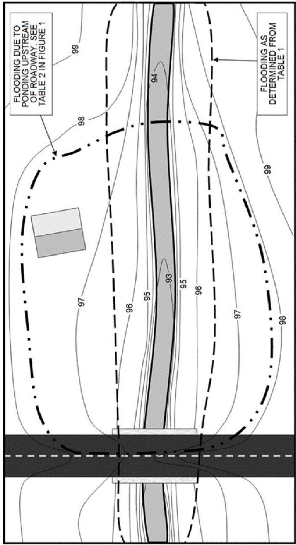
[OCR image]
THIS IS A COURTESY COPY OF THIS RULE. ALL OF THE DEPARTMENT'S RULES ARE COMPILED IN TITLE 7 OF THE NEW JERSEY ADMINISTRATIVE CODE.
FIGURE 4
PLAN VIEW OF AN APPROXIMATE FLOOD HAZARD AREA
NOT DRAWN TO SCALE
PDF page 264, image 1
Mistral ID: img-13.jpeg. Extraction bundle(s): njac7_13_OCR. Original page | Image file
Surrounding OCR excerpt:
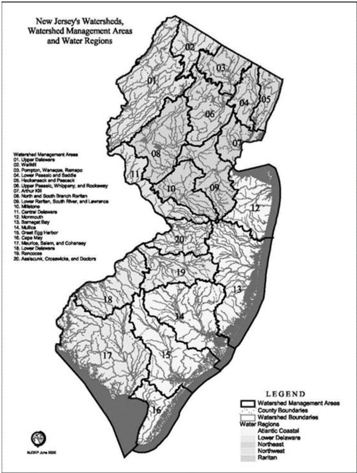
[OCR image]
THIS IS A COURTESY COPY OF THIS RULE. ALL OF THE DEPARTMENT'S RULES ARE COMPILED IN TITLE 7 OF THE NEW JERSEY ADMINISTRATIVE CODE.
FIGURE 5 NEW JERSEY'S WATERSHEDS, WATERSHED MANAGEMENT AREAS, AND WATER REGIONS